- You Are Here:
- Home
- Transportation
- Active Transportation
- Active Transportation Map
Active Transportation Map
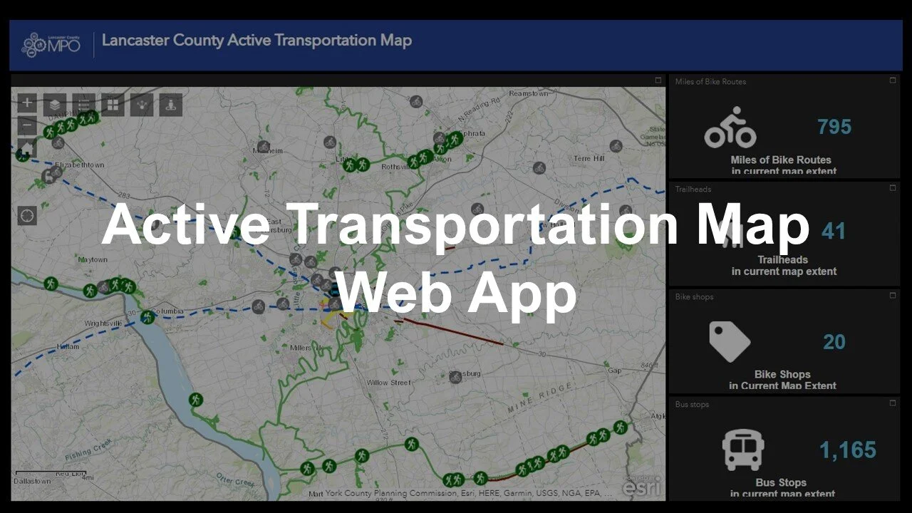
Most maps that you can find online or in print focus on car infrastructure like streets and highways. Our Active Transportation Map shows how we are connected by a network where we can walk, roll, and ride between places. It was developed as part of our Active Transportation Plan. The map is available as a web app and a printed foldout.
The web app includes a number of functions to make your active trip easier:
Asset Dashboard
The web app has four resizable counters that track what is within the area currently on screen. They count the visible number of trail access points, bike shops, bus stops, and bicycle routes miles.
Near Me Tool
When you enter a location into this tool, it will list nearby Active Transportation resources. You can use this to see if any bike shops are in walking distance of your house. You can also see if there is a trail access point within a few miles of your favorite restaurant. Just set a distance for the program to check and then click on the type of resource you are looking for.
Toggleable Layers List
Digital maps show parts of the world in layers. These layers stack on the map like different pizza toppings. There is a layer for bike shops, which are shown as a symbol of a bicyclist. Another layer for bus routes looks like a bunch of lines in a web. When you toggle, or turn off and on, layers on a map, it is like ordering your favorite pizza toppings. Just like you might remove olives to better taste pepperoni, you might want to toggle the bus route layer ‘off’ if it is getting in the way of seeing bike shop locations.
Print Version
We also provide a print version of the Active Transportation Map. You can find it at bike shops, visitor centers, transit stations, libraries, and community centers across Lancaster County. On one side, you will find a map of the county that shows places to walk, roll, and ride. The other side has a map of Lancaster City with a layout of the city’s Bicycle Network. The Bicycle Network is a web of streets designated as easy bicycling routes. That side of the map also has safety tips and instructions on how to bring a bicycle on bus and train rides.
Contact
Kristiana Barr, Principal Planner
kbarr@co.lancaster.pa.us
(717) 299-8333